Our video below addresses three very important climatic teleconnections that may worsen the U.S. wheat crop in the weeks ahead. April and May are critical times for wheat crops in Europe, Ukraine, and most of the U.S.
The key teleconnections that help us develop ETF, futures and option strategies for clients are: 1) A weakened La Niña; B) Lingering negative global atmospheric angular momentum (GLAAM) that can sometimes result in dryness for parts of the Midwest or the Plains; C) A major warm block (-WPO index) in northwestern Alaska that can bring occasional cold snaps to either the U.S. and/or Russia that could threaten wheat yields.
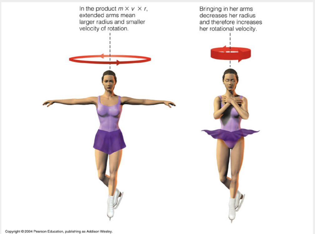
Source: Pearson Education
Global Atmospheric Angular Momentum (GLAAM) is a measure of the total rotation of the atmosphere relative to the Earth. When this index is negative, it indicates that the atmosphere is rotating more slowly (ice dancer on the left) than the Earth’s surface, typically resulting in easterly wind anomalies.
In the spring, a negative GLAAM phase often leads to dryness in the U.S. Great Plains wheat areas. The key point here is that even though La Niña has “officially” weakened to neutral, the atmosphere can still occasionally act as if La Niña is present when GLAAM is negative.
See this five minute video (below) that discusses the developing Plains drought and which factors we are watching.
Source: Jim Roemer & Google’s NOTEBOOK-LM
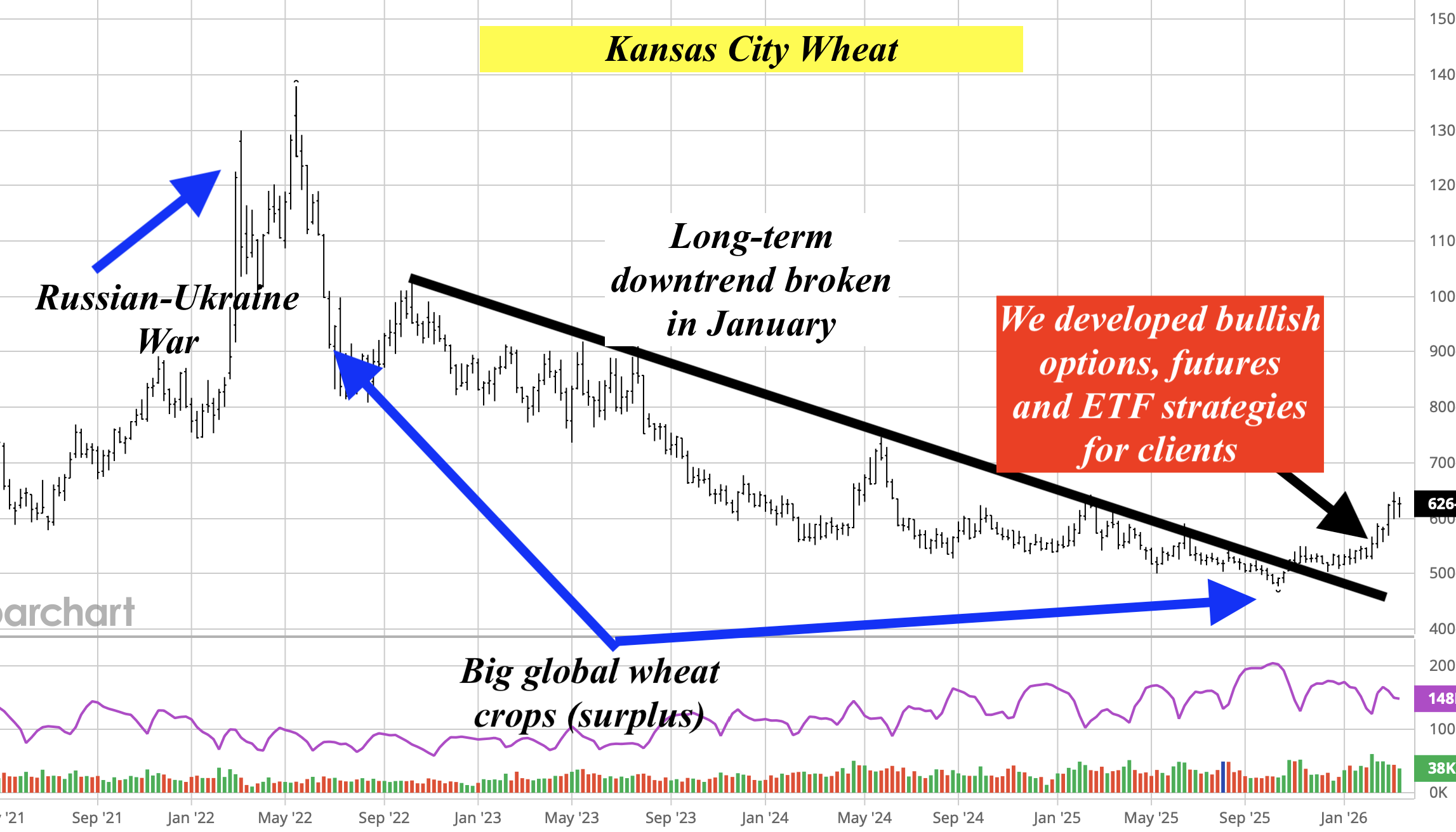
Other factors have influenced wheat prices, resulting in major volatility. They are:
The Middle East war and logistical issues in transporting wheat
The Russian war on Ukraine could lower Ukrainian wheat production
Recent heat stress to crops in India
The stronger U.S. dollar can sometimes hurt grain prices
This video addresses why feet of snow will affect the Northeast and New England for the next two weeks and why a cold mid-winter could last into March for the northern half to two-thirds of the Midwest and eastern U.S.
Click below to learn about A) The Polar Vortex; B) The positive SOI and weak La Niña signal; C) Why skiing in the Northeast and New England will have the best mid-late February conditions in a decade
click on video below of renowned meteorologist and commodity investing analyst Jim Roemer riding out the hurricane in Sarasota.
Windows being blown out of building and trees down. However, the situation for this area could have been a lot worse if Milton did not weaken at landfall. Though NOAA and others are saying it landed as a CAT 3 hurricane, sustained winds of around 80-90 MPH with gusts to 100 or so, was really a strong Cat 2. A big difference, though certainly many communities around Tampa, etc. had severe flooding. Tornadoes were the biggest threat in Florida (a record number)
1) A look at recent rainfall maps in the corn belt and why the grain market has not yet gotten excited about potential hot weather deeper in June or early July;
2) Rainfall forecast for the next 10 days. Some flooding and severe weather are possible in the northwest corn belt. Will this cause some replanting of corn over to soybeans?
3) Strong El Niño events… How often did they transition to La Niña?
4) Why El Niño neutral conditions should exist through at least August.What does this mean? Weather and market volatility with a fluctuating SOI index;
5) Mexico’s record heat and drought. Indications for July temperatures?
6) A look at soft commodities and market action for orange juice, coffee, and sugar;
7) What does another record-warm winter suggest for summer temperatures? Are sunspots to blame?
Please feel free to download a complimentary past issue of WeatherWealth if you have not done so before.
Why corn prices have not rallied in the face of disease issues and lower production in Argentina
The near-historic drought for Vietnam’s coffee & how we called this for clients more than a month ago
Why El Niño-neutral conditions (not La Niña) may persist through the North American summer. This will have implications for potential improved Plains wheat weather and good planting for corn
A look at global crop stress
If you haven’t done so already, please feel free to download a WeatherWealth issue we published two weeks ago:
“How to trade parabolic commodity moves and early season grain weather”here
HELPING YOU MAKE THE BEST INVESTMENT DECISIONS BASED ON THE WEATHER
We use cookies to ensure that we give you the best experience on our website. If you continue to use this site we will assume that you are happy with it.