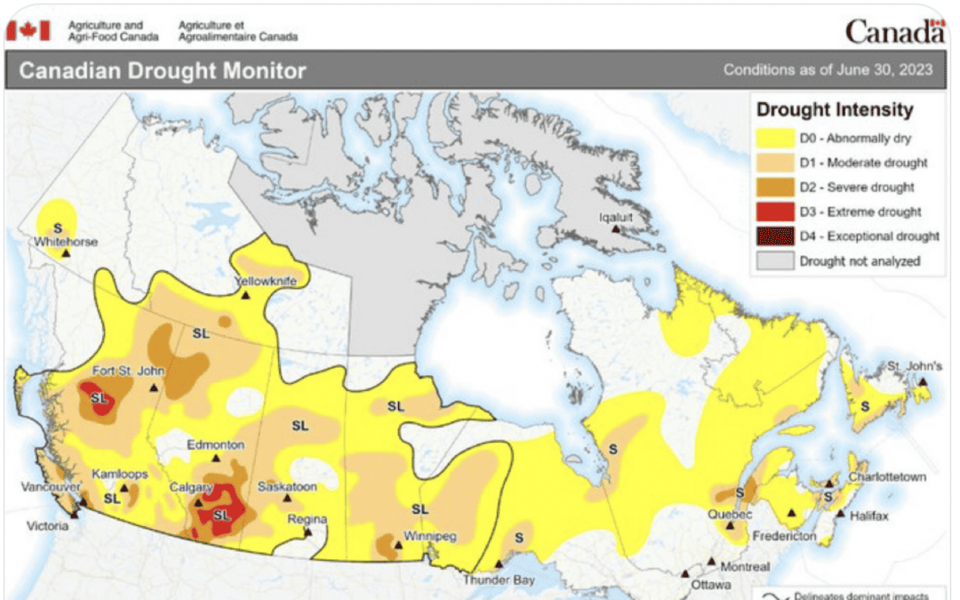
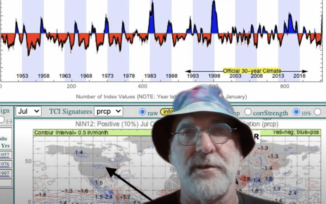
Other than off-again, on-again news about the Ukraine-Russian grain initiative that is affecting trading, this video below talks more about El Nino, the Canada drought, and improving Midwest grain weather.
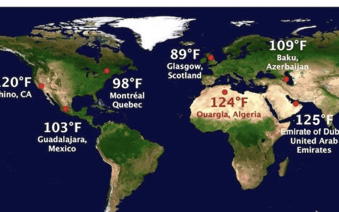
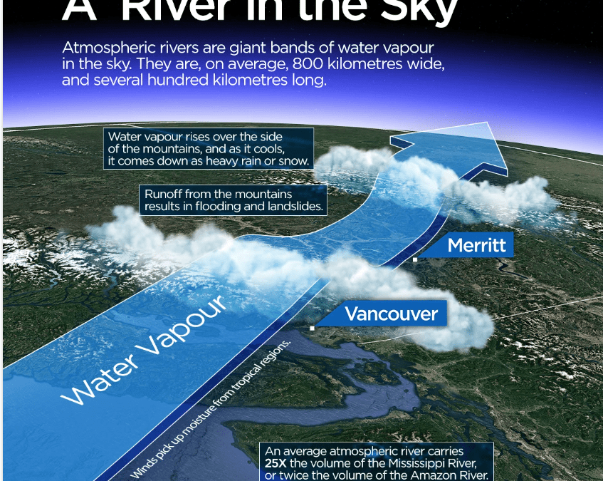
The combination of a warming Arctic and a series of strong storms (Atmospheric River) pounding the west coast is having the following effects on commodities:
Record warm weather in Europe is pressuring Dutch natural gas, as well as the U.S. energy markets
The warmth is also curtailing the demand for coffee
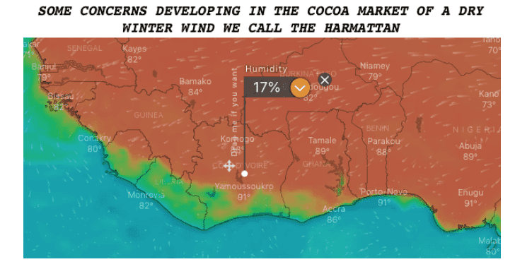
Sometimes when Europe warms, a dry Harmattan wind can hit west Africa. While not a major factor hurting cocoa production yet, it may be, down the road
Jim Roemer
Click below to follow Jim Roemer’s commodity trades and receive a free issue of one of his newsletters
There are many climatological factors that affect the Atlantic and Gulf hurricane seasons. Typically, a La Nina event like we have today reduces wind shear which can help enhance tropical activity. In contrast, El Nino events increase wind shear and reduce the number of storms.
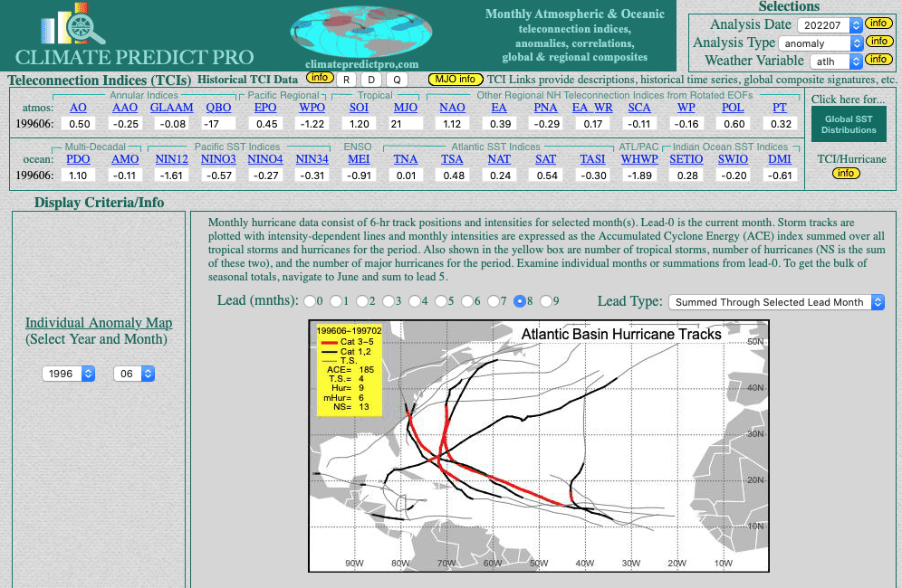
Based on our research and similar global ocean temperatures, the 1996 and 2018 analog may be a good ones. 1996 was a La Nina event with some similar global climatological characteristics. In 2018, Europe also had a severe heat wave in drought that killed thousands of people. African dust also killed the beginning of the hurricane season that year; like this year.
Notice the storm tracks in both of these cases: Mostly out in the Atlantic or along the east coast. In both 1996 and 2018, total named storms were 13 and 14, respectively.
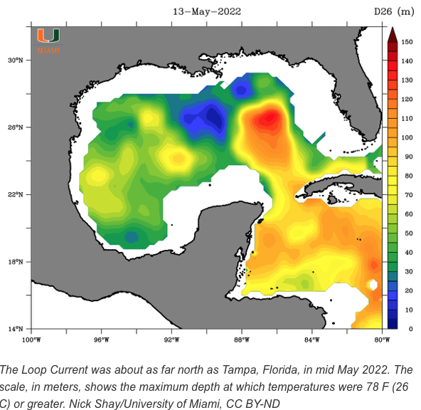
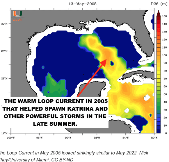
Could this season still reach the projected 17 storms or more that NOAA and others are saying? It could based on climate change and the warm loop current in the Gulf of Mexico (see the discussion below)
So here is what we are thinking at Best Weather about the general storm tracks this year
1996 La Nina and hurricane tracks
2018 was not a La Nina but similar major European heat wave with AFrican dust
and 2018
Why 2022 hurricane season got off to a slow start and what may be changing?
Summer 2022 got off to a slow start due to major African dust that disrupted any development in the Atlantic. However, in the main eastern development region near Africa, African dust is weakening and some tropical storms and hurricanes are forecasted by early September.
Additional factors that influence hurricane development (or not), are the following
The MJO (Gulf of Mexico and Caribbean Sea hurricanes are four times more likely to occur when the MJO is producing enhanced precipitation and divergent upper level winds than when precipitation is suppressed and upper level winds are convergent.)
2. The TNA index (ocean temperatures off the west coast of Africa
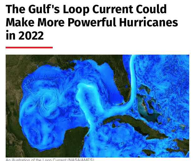
3. The loop current in the Gulf of Mexico (The warm loop current the last few years, brought on by climate change and global warming helped spawn no less than 5 category 5 hurricanes over the last few years out of nothing).
HELPING YOU MAKE THE BEST INVESTMENT DECISIONS BASED ON THE WEATHER
We use cookies to ensure that we give you the best experience on our website. If you continue to use this site we will assume that you are happy with it.OkPrivacy policy