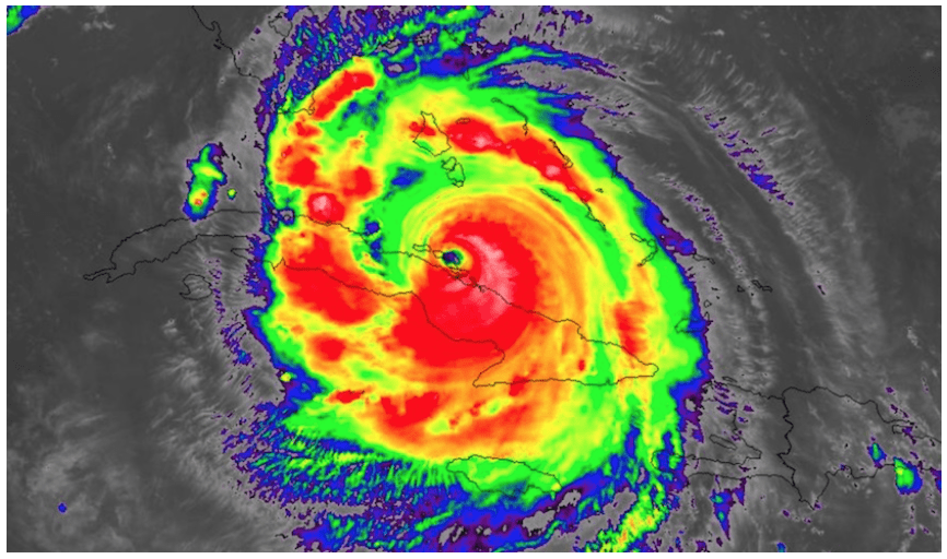
Irma was the strongest storm on record for the Atlantic Ocean.
As a Category 5, Irma was the strongest hurricane on record to impact the Leeward Islands.
Accumulated Cyclone Energy (ACE) is a meteorological criterion based on hurricane (or tropical storm) total energy. Irma broke the record for the highest ACE in a 24 hour period, surpassing Hurricane Allen (1980).
Having lasted for 10.75 days, Irma took the duration record away from Ike (2008).
Irma and the Cuba hurricane of 1932 share the record for the longest time spent in Category 5 strength.
Hurricane Irma measured 915 millibars, making it the lowest pressure of an Atlantic hurricane outside of the western Caribbean and Gulf of Mexico in recorded history.
This was the first time in recorded history that two hurricanes having winds of at least 150 miles per hour coexisted in the Atlantic.
TRADING THE WEATHER
All eyes will not be on Hurricane Jose. For information about Jose’s potential impacts on global stock and commodity markets, sign up for our newsletter heresubscriptionsbestweather@gmail.comThis newsletter will help teach investors how to take advantage of weather intelligence in trading stocks and commodity ETFs.
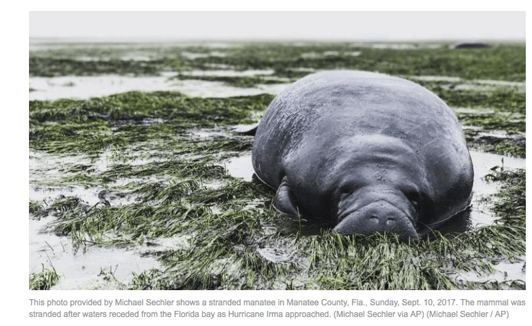
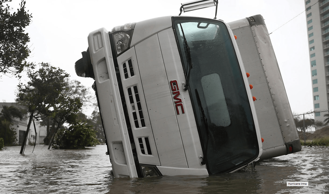
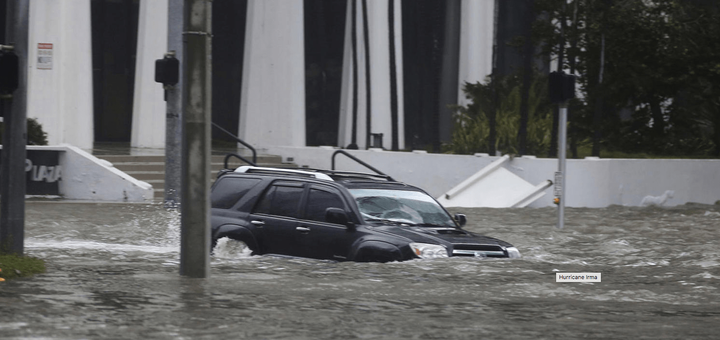
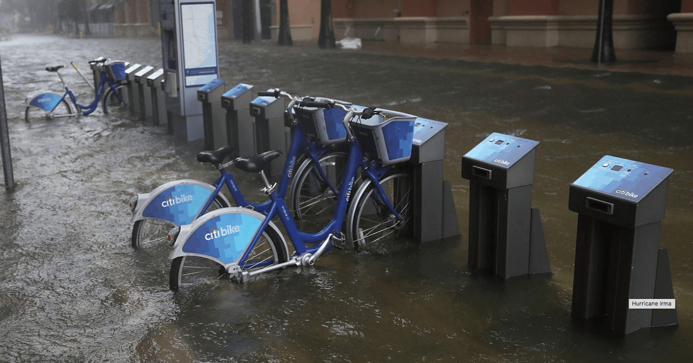
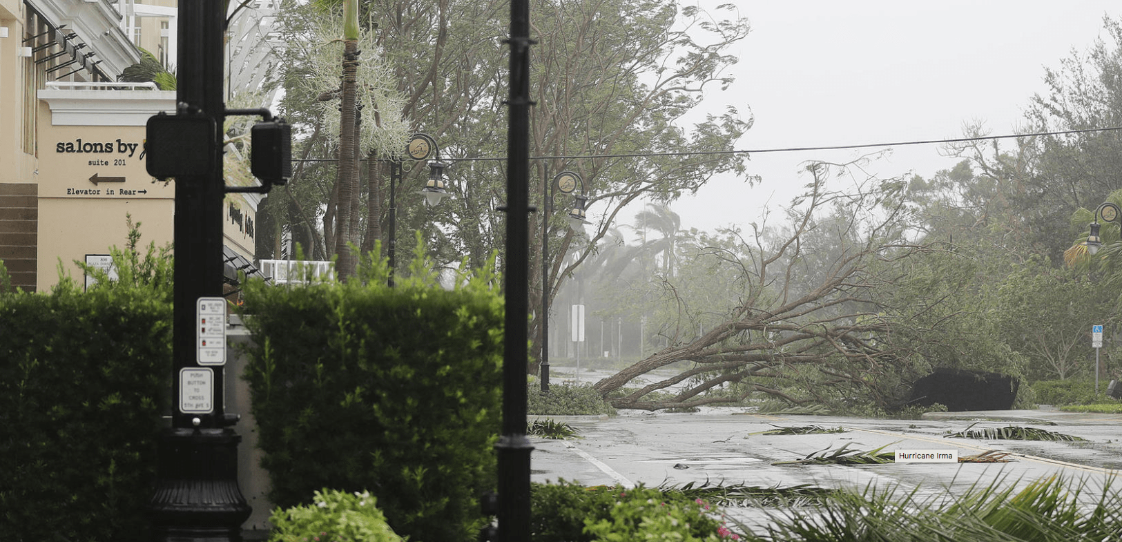
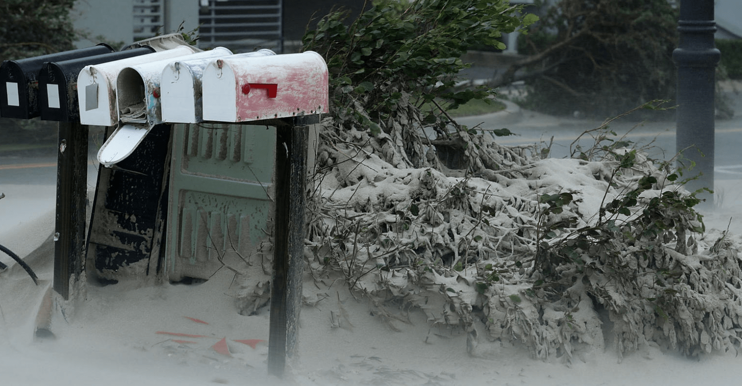
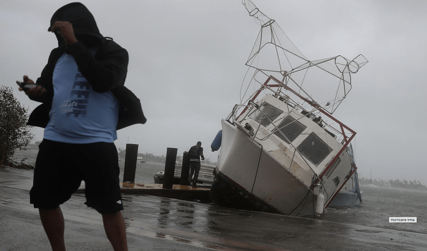
A LOOK AT SOME OF THE DEVASTATION FROM HURRICANE IRMA IN FLORIDA
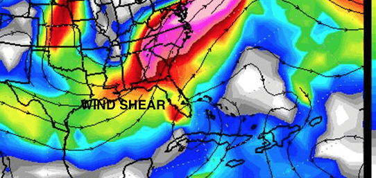
Much of Florida escaped catastrophic damage that might have occurred from a Category 4-5 storm hitting the entire state. Despite this, there were still nearly six million people without power. In addition, there was some destruction along coastal areas where high tidal waters and storm surge were evident. Two factors combined to prevent the storm from being more monstrous. These were the wind shear that we forecasted, along with Irma having passed over Cuba on Saturday. Orange juice, lumber, cotton, and gold are reacting negatively after recently rallying on the psychology of a hurricane crisis. Below are just a few of the many photos taken during, and immediately after, the event.
SOURCE OF PHOTOS BELOW (CNN/ HUFFINGTON POST/AP)
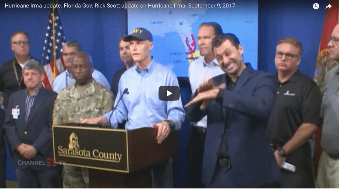
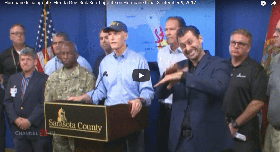
Is the guy on the right saying that Scott has no clue about global warming?
That’s not snow but sand blown in from the beach in southern Florida around Miami.
While Florida officials, police officers, emergency service personnel all did a fabulous job in the face of hurricane Irma, our administration is two-faced. There must be a much greater acceptance of the reality that global warming exists. Not every storm nor drought is due to global warming, of course, but the key point here is that droughts, floods and hurricanes are getting more and more extreme due to climate change.
A coincidence that Al Gore’s new movie came out, just prior to the most active hurricane season in 12 years? Perhaps not. 98.5% of all scientists around the globe believe in a warming planet.
Here’s another point, would you place Russian roulette to win $1 million even if the chances were 15% you would lose? The chances that global warming and a deteriorating planet from deforestation and big coal is more like a 95%. Even if it was only a 15% chance, we can not afford to sit idle and do nothing about it.
I think the fellow in the right of this video, is basically doing sign language that Governor Rick Scott has no clue about what is the right thing to do! I say, accept the fact that Florida may someday be under water from sea-level wise and push the senate and Trump to adopt more sensible legislation toward renewable energy and the Paris Climate Agreement.
SEE VIDEO BELOW. The fellow on the right is basically saying, this administration has no clue about “climate change”
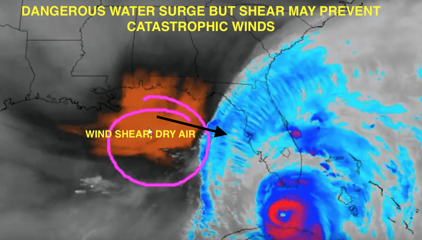
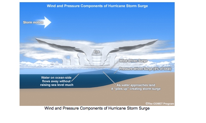
We mentioned as early as Thursday night and especially Friday morning, that Hurricane Irma would move much further west than the hurricane center and others felt. Hence, the panic and evacuations from Miami and eastern Florida was a little too much hype. Nevertheless, it is always important to prepare just in case, especially since storm surge can be the biggest issues in coastal areas. Now the concerns shift to western Florida. The video below explains the complexity of Irma. Sometimes the strongest winds in hurricanes can remain aloft and not always get down the surface. While Irma devastated some islands in the Carribean as a CAT 5, her interaction with Cuba and wind shear closer to the west coast of Florida could prevent Irma from being less catastrophic than many feared. Nevertheless, storm surge from Ft, Meyers to Tampa and flying debris could be more of a concern, than straight line winds.
The video below from early Sunday a.m. discusses the European model and if Irma stays off shore, it could remain CAT 4 status. However, wind shear could well weaken Irma, hence, while there will be coastal flooding and beach erosion, in interior areas of SW Florida (such as Sarasota), Irma may only briefly pack winds of over 90-100 MPH later tonight, as she is potentially down traded.
10 AM Sunday
PLEASE CLICK ON VIDEO ABOVE (Sorry about some of the technical problems–have not slept well for 4 days)—Irma not as brutal in some areas as many feared.
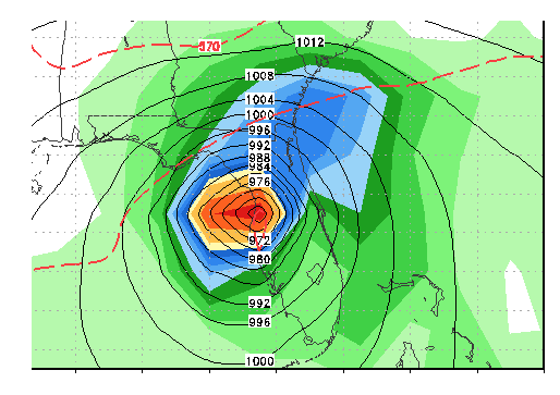
Forecasted track of Irma by 3 am Monday a.m. Weakening is possible if Irma goes inland later today or tonight
The video above talks about Irma as it heads towards Sarasota and Tampa Bay late Sunday night and early Monday. The eye of Irma could pass close to Sarasota. This means that there could be an hour or so of calmness after 1-2 a.m. as winds then shift around from the east and northeast tonight to the west and southeast early Monday a.m. Storm surge along the coast and isolated tornadoes could be more of a concern that straight line winds.
Sometimes the hurricane centers’ wind forecast never makes it down to the surface. So far, winds have not exceeded 100 MPH around the Florida Keys and Miami, even though hurricane hunters have measured category 3-4 winds, aloft.
The video above will explain the complexity of Irma.
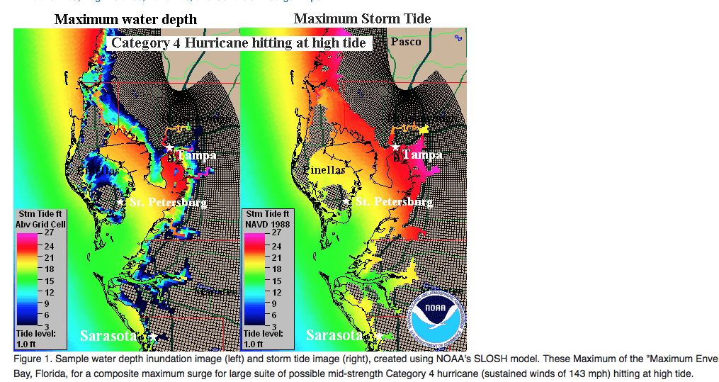
By the way, Tampa Bay does not get hit by many hurricanes. This is because the city faces the ocean to the west and the prevailing east-west Trade Winds there make it uncommon for a storm to make a DIRECT hit no the west coast of Florida. The last time Tampa Bay suffered a direct hit from a hurricane was in 1946 and it only was a CAT 1. The Tampa Bay hurricane of October 25, 1921 was the last major hurricane to hit them. The only other major hurricane to hit the city occurred in September, 1948. That storm caused a 15 foot storm surge and St. Petersburg an Island that it is today. Irma, if she moves in land, however, may be downgraded to a CAT 1 or 2.
The hurricane center and many others helped Florida officials to evacuate the eastern part of Florida, originally. We began discussing quite early Thursday night, a much more western track of Irma. While the Miami area and the east coast of Florida still see coastal flooding and some detrimental effects from Irma, it is really the west coast of the State that may take the brunt. Models have been too far east for days and hence, Irma has a chance to stay out over the water and move towards Ft Meyers or Sarasota. Hence, a CAT 4 hurricane at landfall near Ft. Myers or near Sarasota early Monday a.m, is a distinct possibility. The video also discusses “possible” wind shear that could weaken Irma in time before it does catastrophic damage in western Florida, but confidence is LOW on this, due to the warmer waters.
CLICK ON THE LINK ABOVE TO LISTEN
Longer range weather forecasting, which is our strength for the commodity and financial industry, is often easier than short-term forecasting. However, I have been calling quite often the last couple days, for more of a western track of Irma than many other firms, etc.
As of early this afternoon Saturday, Irma was downgraded to a category 3 storm as it brushed the coast of Cuba. However, I expect it to become a cat 4 or cat 5 storm again due to the warming waters, which has accelerated over the years, due to global warming. The video on youtube above also shows how our proprietary software long-range weather forecast program CLIMATECH, predicted a hurricane season as bad as 2005 (Katrina, etc), and 2010, back in June
Despite some volatility (freeze potential), coffee prices have continued to fall as the Brazil harvest begins. Coffee was up earlier today as Brazil coffee areas had below normal temperatures over the weekend. However, it appears the worry was all for naught, and damaging temperatures (usually below 39°F-37°F) did not occur. Temperature stations showed a minimum of 39.5°F in all coffee areas, with the major producing areas averaging 45°F-60°F. Cold, unfavorable weather is not forecast for at least the next 10 days.
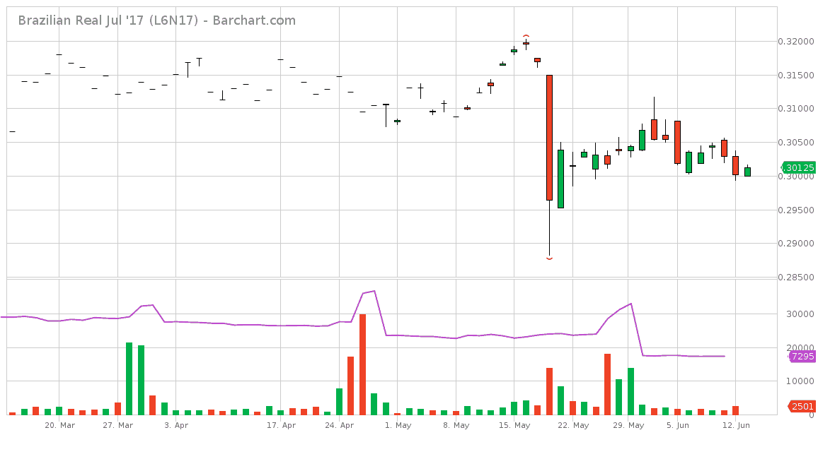
Another reason why coffee continues to fall is the Real, Brazil’s currency. As the U.S. dollar strengthens over the real, U.S. coffee futures can wain in price. In mid-May, a corruption scandal involving Brazil’s president, Michel Temer, was revealed (see price drop below). The Brazil Real crashed as the possibility of a second presidential impeachment in as many years grew. Though no impeachment is imminent, his approval ratings are currently in the single digits. These events and Brazil’s current economy do not provide confidence in a real recovery.
What does a true freeze look like?
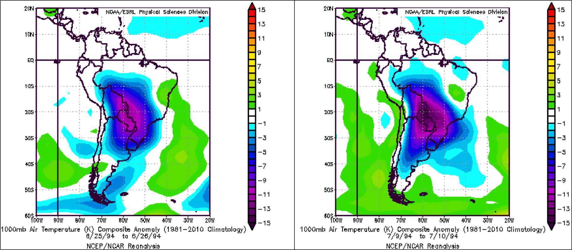
Over the past 20 years or so, there has not been any crippling freezes. Global temperature trends, as well as the northward migration of coffee farms, have helped prevent issues. The last time we saw a major freeze was 1994, which suffered a dose of “double trouble” with dual freezes on June 25th-26th and July 9th-10th. See the maps below:
Temperatures were 10°C to 15°C below normal (on the charts); that’s around a 23°F anomaly! The cold temperatures completely destroyed over a third of the crop. Nearby coffee prices had soared from $1.30 / lb to $2.40 / lb, and the market went up the limit in 12 out of the 14 trading days around the events.
I’m in Europe for the summer. Here, the sentiment I’m getting from almost every news outlet, and from people I’ve met, is that of complete disbelief. There is also a sadness over the Trump administration’s denial about our warming planet, melting polar ice, rising sea levels and the US pulling out of the Paris Climate Accord.
The Paris deal, adopted after decades of climate advocacy, has been hailed by scientists and policy experts as a significant milestone, for both climate science and international cooperation. Scores of countries have affirmed their commitment.
–Jim Roemer
AS ARCTIC SEA ICE SHOWS RECORD DECLINE, SCIENTISTS PREPARE TO GO BLIND
In March 2017, when Arctic sea ice is typically at its winter maximum, circling U.S. satellites recorded an extent of just 5.57 million square miles. This was the lowest maximum in the record’s 38-year history, breaking the previous record set two years earlier and falling nearly half a million square miles below the 1981-2010 long-term average.
It is a well known fact that Arctic sea ice has been seriously declining since 2005, thanks to a series of U.S. Department of Defense satellites that have continuously recorded the region with passive microwave instrumentation since 1979. These satellites have provided scientists, citizens and governments with a thorough record of the changing Arctic. They have informed climate researchers and policy makers with mid-latitude weather predictions and geopolitical analyses. Such information has been useful to international shipping and natural gas exploration companies as the Arctic has continued to melt and open up for exploitation.
But that’s about to change.
The U.S. satellites currently in orbit are already past their expiry date, with some already cutting out. When these satellites fail completely, Arctic researchers warn, the ongoing scientific record keeping will come to an abrupt end, with no funding and no time left to replace the aging infrastructure.
For all intents and purposes, Arctic scientists, and the world, could very soon be blind to the tumultuous changes happening in the Arctic until 2022 or 2023, with no viable international systems coming on board in time to completely fill in the coverage gap.
The fault for the failure lies with a US Congress hostile to funding climate change research. Major cuts were made to the DMSP satellites when Obama was in office, and the situation is unlikely to improve under the Trump administration. In his proposed “skinny” budget released in March, and again in his budget, President Trump called for cuts to NASA satellite missions, including NOAA’s next two polar orbiting satellites.
HELPING YOU MAKE THE BEST INVESTMENT DECISIONS BASED ON THE WEATHER
We use cookies to ensure that we give you the best experience on our website. If you continue to use this site we will assume that you are happy with it.