
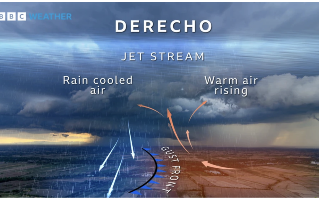
A derecho starts life as a thunderstorm, or cluster of thunderstorms. If conditions are right and there is plenty of warm, humid air at the surface, combined with a strong, straight jet stream, the storm can build into a towering system.
Warm currents of rising air combine with downdrafts of colder, rain-bearing air. These spill out of the bottom of the cloud and spread out horizontally, creating strong bursts of wind. This forces warm air at the surface upwards, creating a “gust front”.
While some minor damage could occur to some Midwest, corn, soybeans and interfere with the soft-red wheat harvest. The odds are low that the important July pollination month for Midwestern corn will see any extensive hot, dry weather. The reason? While El Niño just formed and is weak to start, it may act more like a “strong El Niño”, which rarely results in July Midwest droughts.
Click here to download our FREE Climatelligence Substack App. We will be offering soon a very inexpensive new, commodity-weather service.

See the video regarding two potential Derechos over the next week
