

The natural gas market has whip sawed back and forth, in which traders are almost exclusively watching what happens over Alaska and points north and west.
Any blocking (warm-red signal) over or near Alaska can result in a cold streak, as what will be the case this week in the east with snows by Friday a.m. However, we can see a blue signal for mid January(weakening–blue block) that reminds us of the winter 1998-99 analog. This was a post-El Nino year. This particular winter, we have been fooled a couple times from these occasional cold signals and the bottom line is that persist cold in the U.S. natural gas areas will not persist until there is what we call “a stratospheric warming event.” The red block you see on the other side of the globe is creating a potential negative Arctic Oscillation Index (-AO). Typically, during weak La Nina’s and a -AO, the U.S. energy areas see cold weather. However, this has been an extremely difficult time forecasting week’s ahead, since this La Nina is acting in a non typical fashion. The result has been extreme volatility in the weather forecast and warming signals, for now in the natural as market.
Natural gas traders will be watching closely if the pattern changes over or near Alaska or not.
Right now, we are not at liberty to share our longer term views due to client obligations
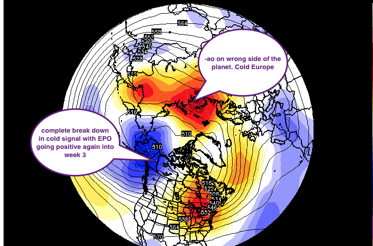
MAP ABOVE IS FROM WSI CORPORATION AND MY PERSONAL COMMENTS
