NEAR RECORD NEGATIVE WPO INDEX SENDS NATURAL GAS PRICES, SOARING. WHAT’S THE WPO?
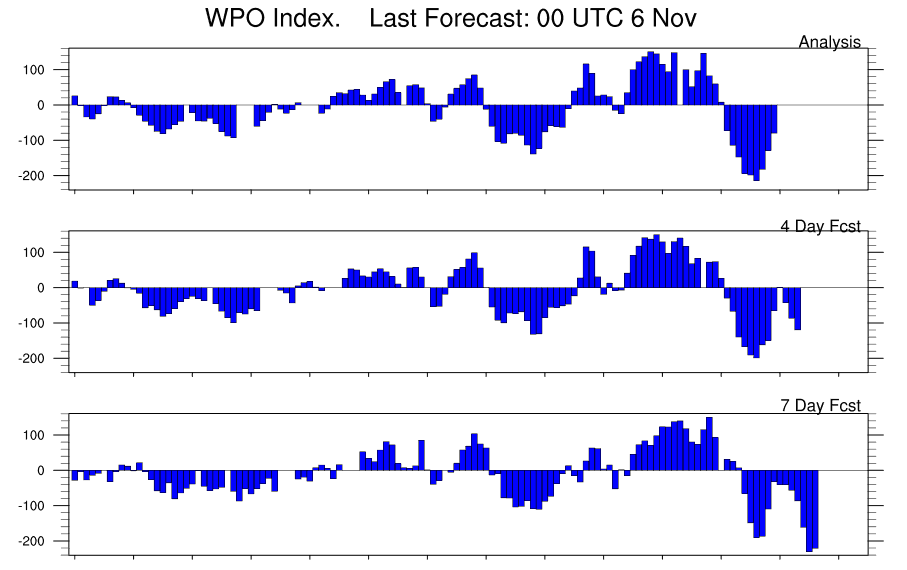
As La Nina forms, and the oceans cool in the equatorial Pacific, winters tend to start out mild for the most eastern ski resorts and the majority of U.S. energy areas, but there are exceptions. 1995 and 1985 were two La Nina events that had a huge block over the NW part of Alaska to the arctic circle. The strong block, or negative Western Pacific Oscillation Index is just one feature that can result in cold weather and will influence natural gas and perhaps heating oil trading in the weeks and months ahead.
The colder outlook has helped natural gas prices soar through resistance, but any short to longer term weather forecasts is only reserved to paying clients. subscriptionsbestweather@gmail.com
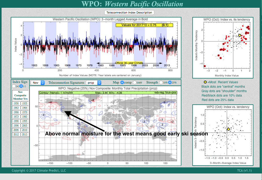
Another important factor to the northern Hemispheric winter is the NAO. Many of you have heard about this index. When there is a warm block over Greenland and the NAO is negative, severe cold and snows can invade the Northeast U.S. and/or Europe. Below we show our proprietary in house software Climatech http://climatepredictanalytics.com and how the WPO index in November can actually forecast a negative NAO. This increases the odds of a cold early start to the winter with lots of fireworks in the energy markets. But how to trade these kind of markets and any changes in the WPO/NAO relationship is only reserved, again, for paying clients.
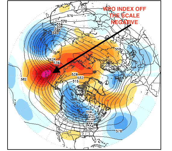
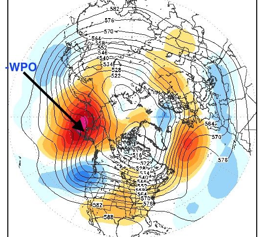
MAP ABOVE WWW.STORMVISTA.COM
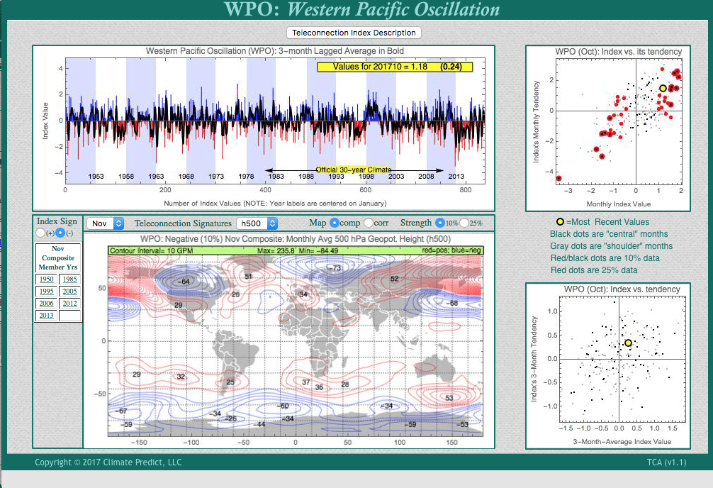
CLIMATECH’S NEGATIVE WPO INDEX——NOTICE THE WARM (RED BLOCK) OVER GREENLAND AND POTENTIAL NEGATIVE NAO