In a wild, volatile market, natural gas is certainly one of them. The weather pattern keeps flipping back and forth between a colder, weak La Nina type, in which big time snows will continue across the west and New England this next week (big shot in the arm for ski areas), vs a weather pattern potentially more similar to late 1988 and 2007. These 2 years were the only cases out of 13 La Nina’s when the weather pattern warmed and stayed that way throughout January. Much of the change in the forecast from cold has to do with a strengthening polar vortex (+NAO) and no additional western or Alaskan ridge to force cold air south.
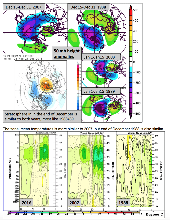
We cannot comment often about the weather pattern for natural gas regions due to client privacy, but one thing we are looking at closely is what is going on in the stratosphere, some 10-20 miles up. Without a major stratospheric warming event, that could cause the pole to warm and send cold air south, we began changing our forecast late last week to clients that some trend towards warmer weather would occur. If cold air does not return in January, natural gas prices could break at least 10% the next month.
The maps below show a comparison of temperatures some 20 miles up in the atmosphere (blue cold; green warm) and some comparisons to the winter of 1998-89; 2007-2008–the only La Nina’s with a very warm January. While not written in stone, subscribers to our service will get update if there are changes in the forecast and our ideas about natural gas prices.


