
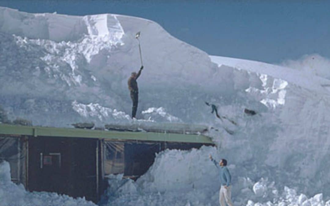
A return of very snowy conditions will be the rule for western ski areas as well as parts of the Plains and western corn belt heading into mid-April. A year ago, places like Snowbird, Utah to Jackson Hole, Wyoming had incredible, early spring ski conditions. More than 400″ to 450″ of snow fell last winter due to a combination of weak El Nino conditions and lower solar activity.
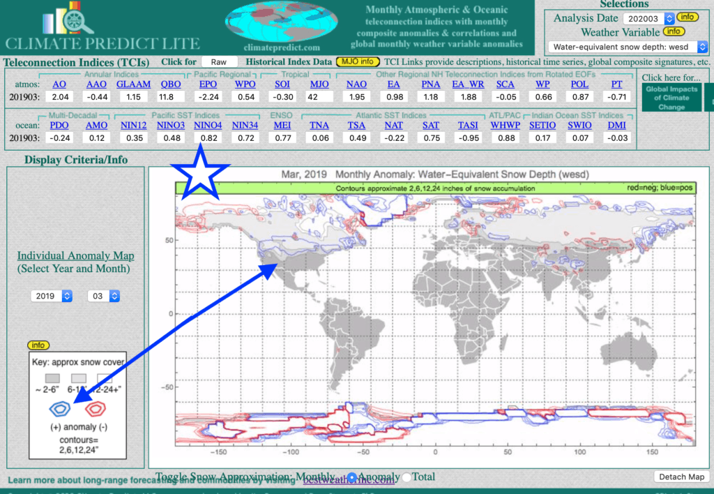
Notice the blue areas and above normal snow-pack in March, 2019 across much of the west into the Dakotas and Canada. The above normal snow-pack and spring-time rains resulted in major flooding and planting delays for corn crops from Iowa to the Dakotas and Minnesota.
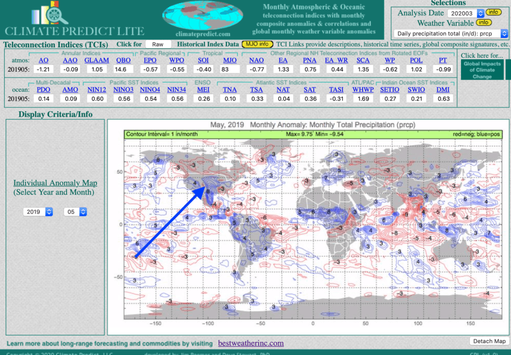
The map above illustrates that by May, 2019, near record rainfall (blue) plagued western Midwest farmers. This was a bullish aspect for the corn market into early June. Then a cooler, drier summer helped corn yields recover and corn prices fell. What will happen this spring and how does one trade the grain market? Find out here.
Now onto this April. We can see a major trough hitting the west in about a week or so. This will bring feet of snow to many western ski resorts, while the eastern US continues to experience a warm winter and early spring (key factors in pressuring natural gas for 4 months).
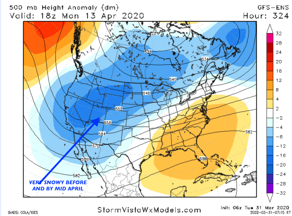
You can see the above normal rainfall over much of the West heading into mid-April. The question many farmers are asking me, ‘Will this slow corn planting again?” After all, given coronavirus and lower crude prices, which are pressuring ethanol and corn prices, it may take a wet spring to get the corn market out of the doldrums.


