CLIMATECH—-HURRICANE SEASON; 2001 ANALOG PATTERN MAY POINT TO NO EL NINO
I mentioned back in May that I thought the hurricane season this summer and fall would be “weaker” than normal with low chances for a MAJOR hurricane in the Gulf Coast and perhaps Florida as well.
However, I mentioned if there was any risk it would be along the East coast of the United States, possibly.
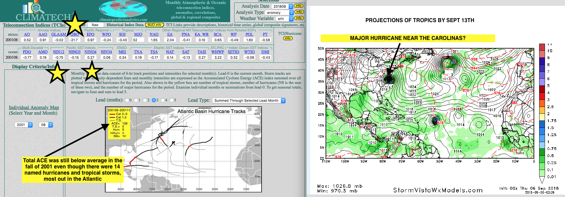
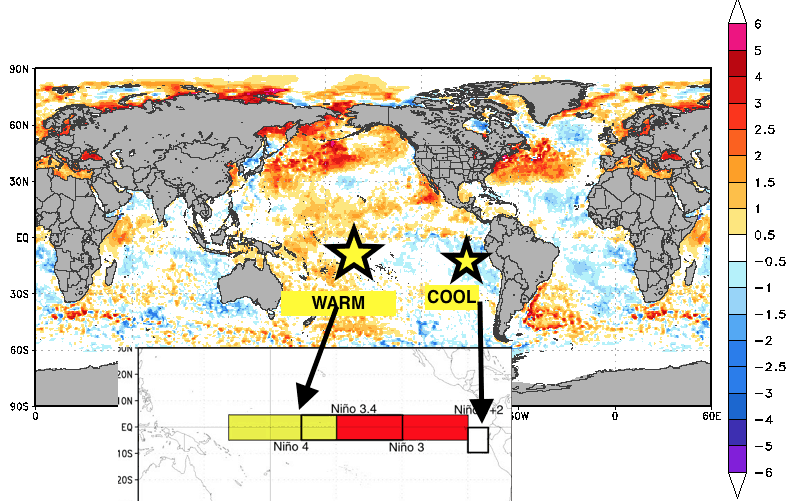
Here we see CLIMATECH on the left. The 3 teleconnections are most similar to today and the 2001 analog. 1) The -QBO and near record easterly stratospheric winds; 2) Nino 1+2 is cooler than normal near Peru; 2) Nino 4, however, is showing warmer than normal temps in the central Pacific.2001 remained mostly an El Nino neutral year through the winter.
This has to do with an El Nino neutral set up currently. The fact there is NO El Nino present yet, illustrates that the hurricane season is heating up. However, the map to the left shows how in 2001 almost all the major hurricanes were out in the Atlantic.
The Map to the right shows the forecast for September 13th and a “possible” major strike along the east coast of the United States.
__________________________________________________________________________________________________________________________________________________________________________________________________________________
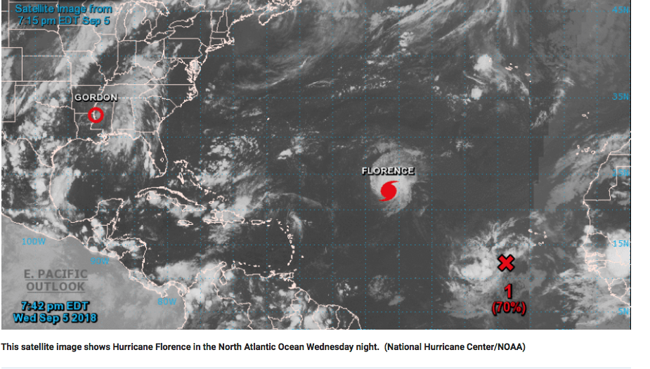
Hurricane Florence could have market impacts in the cotton market and stocks some as Home Depot (HD) and other markets. Our Climatelligence newsletter will discuss which markets will be impacted and for how long. However, historically, impacts to the cotton market are only temporary and often an over-reaction. However, will weather problems develop in other parts of the world for cotton?
To subscribe, please click here