
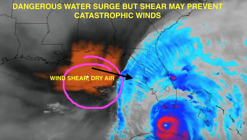
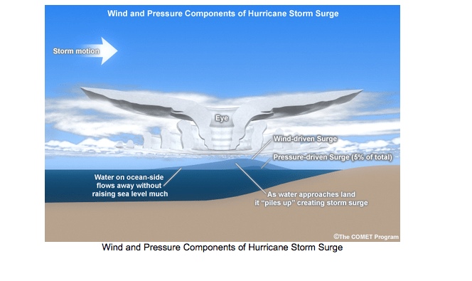
We mentioned as early as Thursday night and especially Friday morning, that Hurricane Irma would move much further west than the hurricane center and others felt. Hence, the panic and evacuations from Miami and eastern Florida was a little too much hype. Nevertheless, it is always important to prepare just in case, especially since storm surge can be the biggest issues in coastal areas. Now the concerns shift to western Florida. The video below explains the complexity of Irma. Sometimes the strongest winds in hurricanes can remain aloft and not always get down the surface. While Irma devastated some islands in the Carribean as a CAT 5, her interaction with Cuba and wind shear closer to the west coast of Florida could prevent Irma from being less catastrophic than many feared. Nevertheless, storm surge from Ft, Meyers to Tampa and flying debris could be more of a concern, than straight line winds.
The video below from early Sunday a.m. discusses the European model and if Irma stays off shore, it could remain CAT 4 status. However, wind shear could well weaken Irma, hence, while there will be coastal flooding and beach erosion, in interior areas of SW Florida (such as Sarasota), Irma may only briefly pack winds of over 90-100 MPH later tonight, as she is potentially down traded.
10 AM Sunday
PLEASE CLICK ON VIDEO ABOVE (Sorry about some of the technical problems–have not slept well for 4 days)—Irma not as brutal in some areas as many feared.
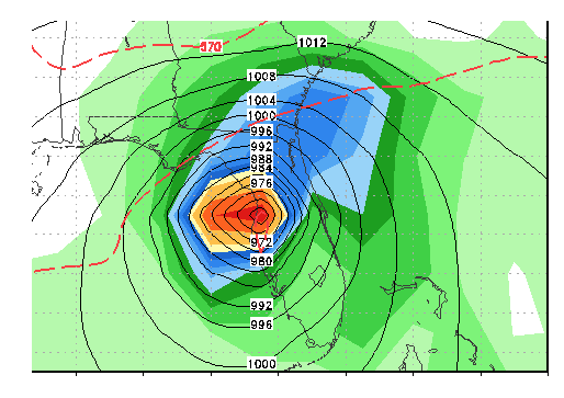
Forecasted track of Irma by 3 am Monday a.m. Weakening is possible if Irma goes inland later today or tonight
The video above talks about Irma as it heads towards Sarasota and Tampa Bay late Sunday night and early Monday. The eye of Irma could pass close to Sarasota. This means that there could be an hour or so of calmness after 1-2 a.m. as winds then shift around from the east and northeast tonight to the west and southeast early Monday a.m. Storm surge along the coast and isolated tornadoes could be more of a concern that straight line winds.
Sometimes the hurricane centers’ wind forecast never makes it down to the surface. So far, winds have not exceeded 100 MPH around the Florida Keys and Miami, even though hurricane hunters have measured category 3-4 winds, aloft.
The video above will explain the complexity of Irma.
By the way, Tampa Bay does not get hit by many hurricanes. This is because the city faces the ocean to the west and the prevailing east-west Trade Winds there make it uncommon for a storm to make a DIRECT hit no the west coast of Florida. The last time Tampa Bay suffered a direct hit from a hurricane was in 1946 and it only was a CAT 1. The Tampa Bay hurricane of October 25, 1921 was the last major hurricane to hit them. The only other major hurricane to hit the city occurred in September, 1948. That storm caused a 15 foot storm surge and St. Petersburg an Island that it is today. Irma, if she moves in land, however, may be downgraded to a CAT 1 or 2.
JIM ROEMER


