The weather pattern is such that tons more snow will fall on western ski resorts through early-mid January, while eastern regions see less optimal conditions. By Christmas, near or record warmth will affect the east, as I advertised eight days ago. While many forecasters point to a La Nina Modaki (west based weak La Nina) to predict a cold January, these teleconnections below say otherwise. A lack of stratospheric warming aloft, plus various factors related to global angular momentum acting more like a weak El Nino, etc., suggest a warm pattern through mid January for much of the eastern half of the U.S. The drought stricken west will receive feet more snow over the next 2 weeks for skiing and will ease the water restriction situation.
Heavy rains in Argentina breaking the soybean market, tons of snow for the western U.S. are all signs that the atmosphere is not necessarily acting like a La Nina, The AO, NAO and other teleconnections will remain positive suggesting warm weather for U.S. energy areas and little chance for a major rally in natural gas prices over the next couple weeks.
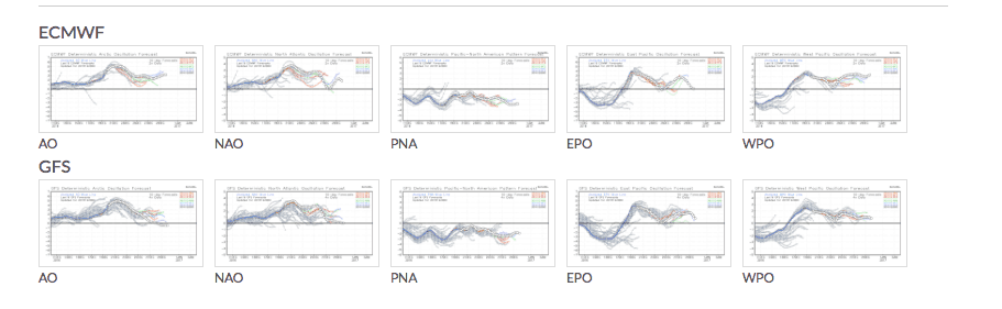
TELECONNECTIONS ABOVE SUPPLIED BY WEATHERBELL, INC.
Places to go Skiing through January 10th are places like Snowbird, Utah, with tons more snow coming with 2 more storms around Christmas and then January 5th. The Sierras, Cascades too will see some of the best late December and early January ski conditions in several years.
www.snowbird.com