

In one of the most Jekyll and Hyde weather patterns in recent memory, much of the country will go from near record warmth next week to potentially very stormy and colder weather towards the end of January and first week of February. The pattern may continue to oscillate back and forth, with higher confidence that March will be quite cold. This is because of low sea ice helping to cause the polar vortex aloft to strengthen and once we head towards spring, this system will be displaced to the South. This could improve snowfall for many eastern ski areas before or by spring.
For now, after melting snow and more mediocre ski conditions in the East, I look for the NAO index to go negative later in January and for the potential for an important east coast snowstorm possible sometime around or after January 27th.
Each pattern change the last 6 weeks has been brought on by some feature entirely different than the previous. In the case coming up for later January, the MJO, stratospheric warming (see blog on January 10th below), plus what we call a retrogressive wave pattern, will open the door for yet another, colder pattern change. However, the way this pattern has been all winter long, I would expect that warmer risks will occur again later, making any major rally in natural gas prices the next few weeks unlikely. Computer models cannot be trusted this year.
MAP FROM WSI CORPORATION OF JET STREAM; COMMENTS BY JIM ROEMER. January 13th
WHAT IS RETROGRESSION?? Colder risks at time, but not consistent will result in more natural gas volatility.
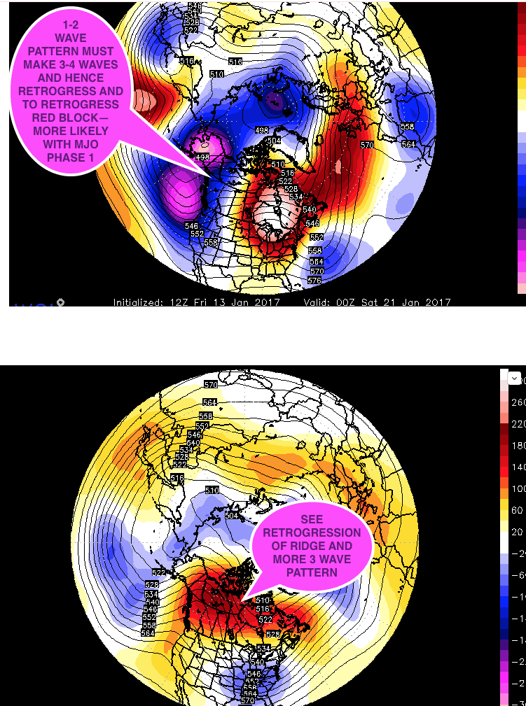
LATE JANUARY PATTERN FOLLOWING UPCOMING WARMTH


