
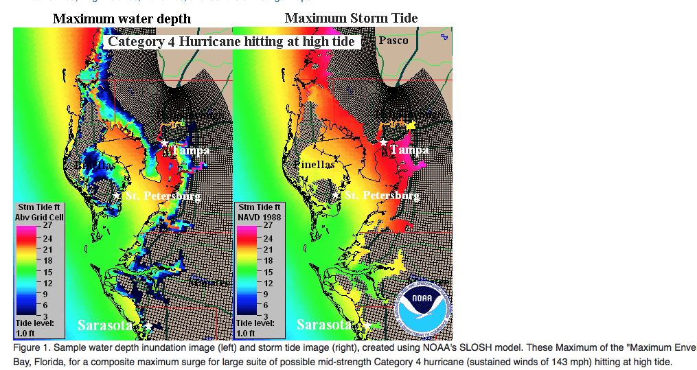
The hurricane center and many others helped Florida officials to evacuate the eastern part of Florida, originally. We began discussing quite early Thursday night, a much more western track of Irma. While the Miami area and the east coast of Florida still see coastal flooding and some detrimental effects from Irma, it is really the west coast of the State that may take the brunt. Models have been too far east for days and hence, Irma has a chance to stay out over the water and move towards Ft Meyers or Sarasota. Hence, a CAT 4 hurricane at landfall near Ft. Myers or near Sarasota early Monday a.m, is a distinct possibility. The video also discusses “possible” wind shear that could weaken Irma in time before it does catastrophic damage in western Florida, but confidence is LOW on this, due to the warmer waters.
CLICK ON THE LINK ABOVE TO LISTEN
Longer range weather forecasting, which is our strength for the commodity and financial industry, is often easier than short-term forecasting. However, I have been calling quite often the last couple days, for more of a western track of Irma than many other firms, etc.
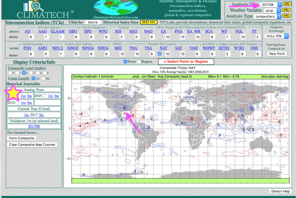
As of early this afternoon Saturday, Irma was downgraded to a category 3 storm as it brushed the coast of Cuba. However, I expect it to become a cat 4 or cat 5 storm again due to the warming waters, which has accelerated over the years, due to global warming. The video on youtube above also shows how our proprietary software long-range weather forecast program CLIMATECH, predicted a hurricane season as bad as 2005 (Katrina, etc), and 2010, back in June
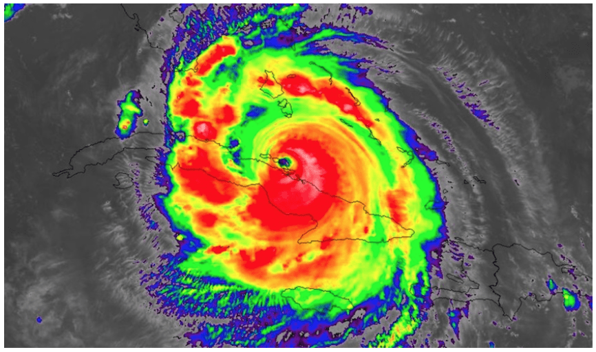
SOURCE OF MAP ABOVE—WEATHERUNDERGROUND


